


La Niña coastal effects checked
 Print
Print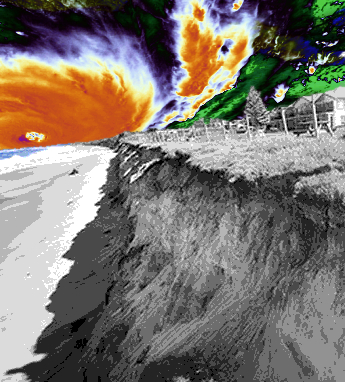 Satellite photos reveal how coastlines respond to different phases of the El-Niño-Southern Oscillation (ENSO) cycle.
ENSO is a natural climate phenomenon that causes variations in sea surface temperatures over the Pacific Ocean. The warming phase, known as El Niño, and the cooling phase, known as La Niña, affect weather patterns across different coastlines depending on the cycle.
During these periods, coastal erosion can also intensify, shifting sand away from beaches and threatening beachfront homes and habitats.
But scientists have not been able to study this broadly using conventional coastal monitoring techniques, which have been limited to on-ground observations on just a few beaches.
In a recent study, researchers from UNSW Sydney analysed millions of satellite photos to observe changes in beaches across the Pacific Ocean.
The researchers developed a new open-source tool called CoastSat, which combines image processing and machine learning algorithms to extract information from every pixel about thousands of sandy beaches along the Pacific rim.
“The tool automatically maps the position of the interface between the sand and water. Doing this over multiple images and beaches, and correcting for the tide, we can discover changes in the coastline over a large temporal and spatial scale and how this correlates with ENSO cycles,” says Dr Kilian Vos, lead author of the study from the Water Research Laboratory.
Using the tool, the researchers processed 38 years of Landsat satellite photos to find correlations in beach width and El Niño and La Niña cycles across more than 8000km of sandy coastline, from the east coast of Australia to the west coast of California and down to Chile.
They found that beaches on the southeast coast of Australia narrow during prolonged La Niña, while they widen - or accrete - during El Niño periods. But beaches on the other side of the Pacific experience the opposite effect - eroding during El Nino and recovering during La Niña.
“While our study is looking at the average behaviour of sandy beaches correlated with the ENSO cycle, this is consistent with what we’ve observed, for example, with the recent triple-dip La Niña in Australia, where successive coastal storms have been stripping sand from beaches along the NSW and QLD coastlines,” says Dr Vos.
As part of the CoastSnap citizen science project, community members share their shoreline photos to create new insights into how beaches respond to changing conditions.
The researchers plan to further analyse the data from both projects to uncover insights on how beaches respond to waves, sea levels and climate change as close to real-time as possible.
More details are accessible here.