


Brisbane flood map updated
 Print
Print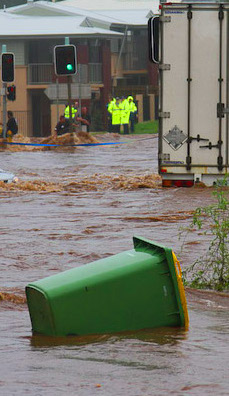 Brisbane City Council has released a new flood map including data from the most recent big downpours.
The council's new Flood Information Online tool includes mapping of overland water flows responsible for unexpectedly flooding thousands of homes in February this year.
Brisbane Lord Mayor Adrian Schrinner says the map is based on about 1,100 ground surveys, 21 hydrology models and 21 hydraulic models.
Flood levels were also surveyed at hundreds of locations, while more than 450 gauges were inspected to gather the data.
Debris markings were recorded at more than 90 locations, helping to show that overland flow more significantly impacted northside suburbs Albion, Windsor, Wilston and Newmarket in 2022, compared to 2011.
“The new Flood Awareness Map has been updated to better display information with clearer navigation, simpler language, and improved functionality across devices,” Cr Schrinner said.
“The online tool also includes a new historic flood layer displaying the extent of the February 2022 flood with mapping for both river and creek flooding included.”