


Murray erosion project launched
 Print
Print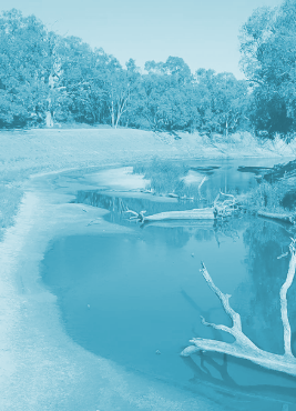 A new project has been launched to fight riverbank erosion along the Murray River.
The new research project will take a whole-of-river view of the Murray River – all 2,500 kilometres of it – to develop a shared understanding of where and why erosion is happening and how this can differ along the Murray.
Authorities say the project will lay the groundwork to shape priorities to address erosion where possible. It will be undertaken through the $20 million Australian Government’s Murray–Darling Water and Environment Research Program (MD-WERP).
There are many causes of erosion, which vary from location to location, and year to year, making erosion a complex issue to understand and solve.
It is entirely natural for the riverbanks to erode and for stream channels to move. However, this erosion can sometimes be distressing as it affects agricultural land, community infrastructure, cultural heritage, and natural habitats too.
By taking a close look at the issue of riverbank stability, the $80,000 research project will collate and document the factors that influence erosion along the Murray River. It will also provide the community with information to build a shared understanding of what influences erosion and to help clarify roles and responsibilities relating to erosion along the Murray River within each state.
A Murray River channel monitoring plan is also proposed as part of the project which will enable both benchmarking of erosion and monitoring of change over time.
This will also inform decision-making for future investment. The Murray–Darling Basin Authority (MDBA) will be commissioning experts to deliver this critical work. The project is expected to be complete by December 2022.